BRRTS

Updates To The Bureau Of Remediation And Redevelopment Tracking System (BRRTS) On The Web (BOTW)

The Bureau of Remediation and Redevelopment Tracking System (BRRTS) on the Web (BOTW) has undergone updates to its Search webpage and added Great Lakes Area of Concern (AOC) information.

Search Page

The BOTW Search webpage has been redesigned to eliminate scrolling. No content has been changed.

Great Lakes Area of Concern (AOC)

“Great Lakes AOC” is now a search criterion on the BOTW Search webpage. Great Lakes AOCs are geographic areas designated by the U.S. Environmental Protection Agency (U.S. EPA) where significant impairment of beneficial uses has occurred as a result of human activities at the local level. Clicking the “Great Lakes AOC” search criteria on BOTW will limit search results to those BRRTS sites within the designated AOCs. AOC information has been added to BOTW Supplemental webpage (provides a list of all BRRTS sites within the designated AOCs in Wisconsin), AOC Detail webpage (defines AOC and provides details for each Wisconsin AOC), and an AOC activity banner has been added to relevant sites.

Please contact Sonya Rowe at Sonya.Rowe@wisconsin.gov if you experience any technical issues.

DNR’s Database Of Remediation And Redevelopment Activities Can Help Local Governments

The Wisconsin Department of Natural Resources (DNR) maintains a public database of locations with remediation and redevelopment activities in Wisconsin.

The database is referred to as the DNR’s Bureau of Remediation and Redevelopment Tracking System on the web. A visual display of much of the information is available on the web-based mapping system, RR Sites Map.

Over 95,000 properties are in included in the database. Contaminated sites (i.e., the physical area of environmental contamination) affect properties in all counties and in approximately 95% of all cities, towns and villages in Wisconsin. The system includes links to numerous letters, reports and other information about the properties.

The DNR encourages local governmental units to use the database and RR Sites Map to identify contaminated and cleaned up properties within their communities. Information from the database and RR Sites Map may be useful to local governments when:

  • Identifying potential health and safety concerns in the community
  • Evaluating potential real estate transactions (e.g., conducting due diligence activities prior to the initiation of condemnation, tax foreclosure and other property acquisitions efforts)
  • Considering issuance of permits or approving plans for development – this includes understanding the status of contamination at sites where the cleanup is complete because residual contamination may affect the allowed uses and redevelopment options for a property, or require ongoing maintenance (e.g., caps over contaminated areas)
  • Reviewing proposed public works and utility projects to determine feasibility and whether contaminated material needs to be managed
  • Understanding the status of the property within the cleanup process, including what types of contamination is present, what needs to be done to satisfy regulatory requirements, and who is responsible for completing the necessary work

DNR staff are also available to help. Local governments can contact a brownfields specialist or schedule a “Green Team” meeting with DNR to discuss specific properties.

For more information about how to use the database, go to https://dnr.wisconsin.gov/topic/Brownfields/botwHelp.html

RR Program’s Contaminated Sites Database Viewer Updated

The Remediation and Redevelopment (RR) program has updated the public interface of its online database of open and closed cleanup sites with new functions and a style that matches the DNR’s redesigned website.

BRRTS On The Web (BOTW) is our searchable, public database that allows users to find information about the investigation and cleanup of environmental contamination in Wisconsin.

Continue reading “RR Program’s Contaminated Sites Database Viewer Updated”

Reminder: Issues & Trends Webinar on March 16, 2021: BRRTS on the Web (BOTW) Updates and Highlights of the RR Sites Map (RRSM) User Survey

The Remediation and Redevelopment (RR) program reminds you that the next webinar in the Issues & Trends series will take place on Tuesday, March 16, 2021 from 12:00 p.m. to 1:00 p.m.

The scheduled presentation features updates to BRRTS on the Web (BOTW) and highlights of the user survey related to the RR Sites Map (RRSM).

A Zoom web conferencing registration link, along with a schedule of future Issues & Trends presentations, may be found on the RR Program’s Conferences and Training webpage.

Danielle Wincensten and Jesse Papez, data services and GIS specialists with the RR program will demonstrate recent improvements to BOTW and discuss results of a user survey, including ways that survey responses have been, and could be, addressed in the RRSM application. BOTW and RRSM are the two applications that allow the public to access the RR program’s online database of Wisconsin’s contaminated land activities.

Recordings of previous Issues & Trends webinars can be found in the RR Program’s Training Library.

NR 700 Semi-Annual Reporting Due Soon

Semi-annual reporting for the period of July 1, 2018 to December 31, 2018 is due February 1, 2019. Semi-annual reporting is required of responsible parties (RPs) for all “open” sites, including those sites the DNR formerly classified as “conditionally closed” in the BRRTS online database. Consultants may submit these reports on behalf of the RPs.

An email from the DNR with your unique report identification number was sent during the first week of January 2019. If you did not receive an email, you can request a Report ID number by submitting the Report ID Request Form. The Report ID number you will receive uniquely identifies the activity for which you wish to report, the reporting period, and verifies the person using the ID is authorized to submit the report. If you have any questions, please contact Tim Zeichert at (608) 266-5788.

Continue reading “NR 700 Semi-Annual Reporting Due Soon”

Material Management Activity Type Now Available in BRRTS

A new tracking code entitled, Material Management (MM), has been created within the Bureau of Remediation and Redevelopment Tracking System (BRRTS) to identify sites and facilities that have accepted contaminated soil or other solid waste with an exemption from certain solid waste program requirements through Wis. Admin. Code §§ NR 718.12 or NR 718.15.

BRRTS numbers assigned to the MM activities codes will have a ‘15’- prefix.  Only the main actions (e.g., an interim or remedial actions) and continuing obligations (e.g., engineering control for direct contact threats) directly related to the material management activity will be tracked as an MM activity on the receiving site or facility.  All interim or remedial actions involving Wis. Admin. Code ch. NR 718 materials management will be concurrently tracked at the ERP or LUST source property where the contaminated material was excavated.  The exception would be for continuing obligations imposed on the site or facility receiving the material.

The MM tracking code was created to allow the public to use BRRTS on the Web (BOTW) to clearly identify sites or facilities where contaminated soil and other solid waste was received and how it is being managed.  For actions approved by DNR in April 2018 and forward, BOTW can be used to search for sites and facilities where a Wis. Admin. Code §§ NR 718.12/718.15 exemption was granted.  Only actions directly related to Wis. Admin. Code §§ NR 718.12 and 718.15 materials management will be listed in each MM activity, allowing users to efficiently obtain information specifically related to these activities.

An MM activity will be opened for sites and facilities where a Wis. Admin. Code §§ NR 718.12 or NR 718.15 exemption was granted after March 29, 2018.    At this time, the DNR does not intend to retroactively create MM activities at sites or facilities where Wis. Admin. Code §§ NR 718.12 or NR 718.15 exemptions were previously granted due to workload challenges.

Any questions regarding this process may be addressed to Paul Grittner at (608) 266-0941 or paul.grittner@wisconsin.gov.

Wisconsin’s Remediation and Redevelopment Database

RR Sites Map Mobile Device

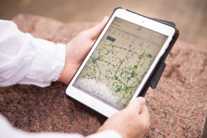
RR Sites Map is accessible via desktop computers, tablets and smart phones.

The Remediation and Redevelopment (RR) Program in the DNR oversees the investigation and cleanup of environmental contamination and the redevelopment of affected properties in Wisconsin. The RR Program also maintains a public database that contains information about known hazardous substance discharges to the environment, investigations, cleanup activities, closure requests, remaining actions needed, spills requiring emergency attention and more. This public database is called the Bureau of Remediation and Redevelopment Tracking System (BRRTS) on the Web (BOTW).

BOTW is augmented by an associated GIS mapping application, called RR Sites Map, which provides a visual representation of data available in BOTW. This interactive map allows users to geographically search for open and closed sites, obtain basic information about a site, click on a link that goes directly to full site information, and more. RR Sites Map is accessible via desktop computers, tablets and smart phones.

Together, BOTW and RR Sites Map are collectively referred to as the Wisconsin Remediation and Redevelopment (RR) Database (WRRD). These two public tools provide easy online access to detailed information about conditions and environmental activities at tens-of-thousands of cleanup sites around the state. This database was formerly referred to as CLEAN, the Contaminated Lands Environmental Action Network.

BOTW Database Has Documents for Download

Did you know there are over 30,000 documents available for viewing and downloading on the Bureau for Remediation and Redevelopment Tracking System (BRRTS) on the Web (BOTW) database? BOTW is DNR’s online, public database that provides information about contaminated properties and other activities related to the investigation and cleanup of contaminated soil or groundwater in Wisconsin.

The DNR’s RR Program is adding new documents daily and working toward the goal of having the major reports, approvals and letters for all clean-up case files available online. Contact one of our Regional Environmental Program Associates (EPA) before making any plans or appointments to visit an office to review a file. There is a chance it is now available electronically.