Data and Databases

RR Program Phasing Out the Term “GIS Registry”

The words “GIS Registry” were removed from such popular Remediation and Redevelopment (RR) Program resources as RR Sites Map, BRRTS on the Web (BOTW), and the Case Closure Form (please note that the content and requirements of the Case Closure form did not change).

This is a deliberate and ongoing effort by the RR Program to update the outdated term “GIS Registry.” Instead, you may see or hear staff refer to the “Continuing Obligations Packet” (formerly the GIS Registry Packet), “database fees” instead of GIS fees, or “the database,” when discussing where to find information about sites with continuing obligations.

Regardless of how it’s stated, all sites with residual contamination and/or continuing obligations are required to be listed on the Wisconsin Remediation and Redevelopment Database (WRRD), comprised of BOTW and RR Sites Map.

In the coming months, RR Program staff will continue to remove “GIS Registry” from our forms and documents. Most of the RR Program web pages are already updated. If you have any questions please contact Jenna Soyer, the Fiscal and Information Technology section chief, at 608-267-2465 or Jenna.Soyer@wisconsin.gov.

New Features for RR Sites Map

RR Sites Map is the online companion to the DNR’s Remediation and Redevelopment database of known environmental contamination and cleanup cases in Wisconsin. It allows users to find sites visually and geographically, and then drill down into the database for further details, if desired. 

RR Sites Map Screenshot

RR Sites Map is part of the DNR’s Wisconsin Remediation and Redevelopment Database (WRRD), an inter-linked system tracking information on different contaminated land activities.

RR Sites Map works on desktop computers, phones, and other mobile devices. It’s a great way to get information about closed and continuing remediation activities.

The DNR seeks to continually improve user experiences with this application. Recent updates include:

  • Removed the “GIS Registry” layer group. 
    • The term “GIS Registry” was used in the past to refer to sites that were closed with residual contamination. The DNR now uses the term “Continuing Obligations”, along with a list of these obligations in the closure letter, to let the public know residual contamination exists and that some ongoing requirements exist to continue protecting public health. Sites with “Continuing Obligations” now have their own layer.
  • Added the new “Additional Site Information” layer group. 
    • This new layer group includes both the new “Continuing Obligations” layer and preexisting “Impacted Another Property” layer, which identifies sites with migrating contamination. 
  • Added aerial photos from 2017 to the base maps and image slider tool. 
  • Changed the name of the “Contaminated and Cleaned Up Sites” layer group to “Open & Closed Sites.” 
  • Added a “Layer Catalog” button to the data and tasks tab. 
    • After clicking the button, select the desired GIS data layers and they will appear in the left-side layers panel along with the default layer options.
    • New layer options include: DNR office locations; private water well locations; dual aquifers; landfills with 1,200-foot buffers; areas where special well casing is required; and other agency data such as soil types, hydric ratings and drainage classes.

Let us know how you use RR Sites Map, and please share your suggestions for improvement by emailing them to DNRRRBRRTSFeedback@wisconsin.gov.

Wisconsin’s Remediation and Redevelopment Database

RR Sites Map Mobile Device

RR Sites Map is accessible via desktop computers, tablets and smart phones.

The Remediation and Redevelopment (RR) Program in the DNR oversees the investigation and cleanup of environmental contamination and the redevelopment of affected properties in Wisconsin. The RR Program also maintains a public database that contains information about known hazardous substance discharges to the environment, investigations, cleanup activities, closure requests, remaining actions needed, spills requiring emergency attention and more. This public database is called the Bureau of Remediation and Redevelopment Tracking System (BRRTS) on the Web (BOTW).

BOTW is augmented by an associated GIS mapping application, called RR Sites Map, which provides a visual representation of data available in BOTW. This interactive map allows users to geographically search for open and closed sites, obtain basic information about a site, click on a link that goes directly to full site information, and more. RR Sites Map is accessible via desktop computers, tablets and smart phones.

Together, BOTW and RR Sites Map are collectively referred to as the Wisconsin Remediation and Redevelopment (RR) Database (WRRD). These two public tools provide easy online access to detailed information about conditions and environmental activities at tens-of-thousands of cleanup sites around the state. This database was formerly referred to as CLEAN, the Contaminated Lands Environmental Action Network.

BOTW Database Has Documents for Download

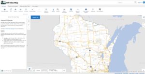
Did you know there are over 30,000 documents available for viewing and downloading on the Bureau for Remediation and Redevelopment Tracking System (BRRTS) on the Web (BOTW) database? BOTW is DNR’s online, public database that provides information about contaminated properties and other activities related to the investigation and cleanup of contaminated soil or groundwater in Wisconsin.

The DNR’s RR Program is adding new documents daily and working toward the goal of having the major reports, approvals and letters for all clean-up case files available online. Contact one of our Regional Environmental Program Associates (EPA) before making any plans or appointments to visit an office to review a file. There is a chance it is now available electronically.