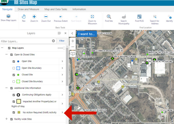
DNR staff recently completed a project which added geographic information for No Action Required (NAR) activities on RR Sites Map.
NAR activities are sites where after notification of a hazardous substance discharge the DNR determined that the responsible party did not need to undertake an investigation or cleanup in response to that discharge because there was no or insignificant contamination.
This information is accessible as a new layer on RR Sites Map and the DNR GIS Open Data Portal. This layer provides users with direct access to over 11,000 additional activity locations on RR Sites Map.
Users can access map layers by selecting Navigate on the top menu bar. Select “Show Map Layers” and expand the “Additional Site Information” menu to check the “No Action Required (NAR) Activity” layer. This will populate the map with small yellow boxes with an activity number beginning with “09.” The prefix “09” is used for NAR activities in BRRTS on the Web (BOTW).

